Category:Wicken, Cambridgeshire
Jump to navigation
Jump to search
village and civil parish in Cambridgeshire, United Kingdom  | |||||
| Upload media | |||||
| Instance of | |||||
|---|---|---|---|---|---|
| Location | East Cambridgeshire, Cambridgeshire, East of England, England | ||||
| Said to be the same as | Wicken (Wikimedia duplicated page, civil parish) | ||||
 | |||||
Subcategories
This category has the following 9 subcategories, out of 9 total.
C
- Cam Washes (5 F)
U
- Upware (19 F)
- Upware Bridge Pit North (3 F)
- Upware North Pit (5 F)
- Upware South Pit (6 F)
W
- Wicken Windmill (7 F)
Media in category "Wicken, Cambridgeshire"
The following 200 files are in this category, out of 549 total.
(previous page) (next page)-
 'Mayfly' on Wicken Lode - geograph.org.uk - 3489004.jpg 1,280 × 856; 322 KB
-
 'The Maid's Head' inn at Wicken - geograph.org.uk - 507439.jpg 640 × 423; 70 KB
-
 7, Pond Green (geograph 6856052).jpg 1,024 × 684; 138 KB
-
 7, Pond Green (geograph 6856063).jpg 1,024 × 684; 174 KB
-
 A boater's view of Wicken Lode, Wicken Fen - geograph.org.uk - 5816851.jpg 1,024 × 768; 223 KB
-
 A distinctive looking tree - geograph.org.uk - 4305371.jpg 640 × 430; 85 KB
-
 A drainage windmill - geograph.org.uk - 5704294.jpg 2,000 × 1,333; 2.13 MB
-
 A hill of peat - geograph.org.uk - 4310658.jpg 640 × 430; 53 KB
-
 A track on Wicken Fen - geograph.org.uk - 5006379.jpg 1,920 × 1,080; 667 KB
-
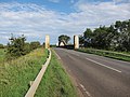 A1123 crossing the Cam - geograph.org.uk - 2574156.jpg 1,600 × 1,200; 816 KB
-
 A1123 crossing the Cam - geograph.org.uk - 2574165.jpg 1,600 × 1,200; 858 KB
-
 A1123, Dimmock's Cote Rd - geograph.org.uk - 4311016.jpg 640 × 430; 46 KB
-
 A1123, Dimmock's Cote Rd - geograph.org.uk - 4311018.jpg 640 × 430; 48 KB
-

-
 Along Wicken Lode in May (1) - geograph.org.uk - 4972997.jpg 1,024 × 768; 224 KB
-
 Along Wicken Lode in May (2) - geograph.org.uk - 4973042.jpg 1,024 × 768; 249 KB
-
 Approaching Dimmock's Cote Bridge - geograph.org.uk - 3641323.jpg 640 × 367; 200 KB
-
 Approaching Wicken Fen - geograph.org.uk - 5704287.jpg 2,000 × 1,333; 1.97 MB
-
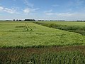
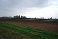
 Arable field near Upware - geograph.org.uk - 4322561.jpg 640 × 430; 73 KB
-
 At Padney in spring - geograph.org.uk - 5765937.jpg 1,024 × 683; 773 KB
-
 At the end of Padney Drove - geograph.org.uk - 5765926.jpg 1,024 × 1,024; 1.21 MB
-
 Autumn colours - geograph.org.uk - 4322572.jpg 640 × 430; 67 KB
-
 Barley field, Fidwell Fen - geograph.org.uk - 4623172.jpg 2,560 × 1,920; 1.86 MB
-
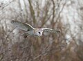 Barn owl near Upware - geograph.org.uk - 5303771.jpg 1,073 × 791; 126 KB
-
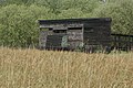
 Barns at Padney Farm - geograph.org.uk - 5765934.jpg 1,024 × 683; 677 KB
-
 Bird hide - Wicken Fen - geograph.org.uk - 3488732.jpg 1,280 × 856; 347 KB
-
 Bird Hide, Kingfisher's Bridge Reserve - geograph.org.uk - 4305375.jpg 640 × 430; 120 KB
-
 Bird Hide, Kingfisher's Bridge Reserve - geograph.org.uk - 4310639.jpg 640 × 430; 103 KB
-
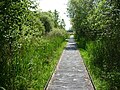
 Boardwalk (north-east side), Wicken Fen - geograph.org.uk - 5816824.jpg 1,024 × 768; 247 KB
-
 Boardwalk (north-west side), Wicken Fen - geograph.org.uk - 5816834.jpg 1,024 × 768; 398 KB
-
 Boardwalk - Wicken Fen - geograph.org.uk - 3488407.jpg 1,280 × 856; 425 KB
-
 Boardwalk at Wicken Fen - geograph.org.uk - 5704302.jpg 2,000 × 1,333; 2.66 MB
-
 Boardwalk on the lode's north bank, Wicken Fen - geograph.org.uk - 5817186.jpg 1,024 × 768; 197 KB
-
 Boat near Dimmock's Cote Bridge - geograph.org.uk - 4056619.jpg 4,320 × 3,240; 5.27 MB
-
 Boat on the Cam - geograph.org.uk - 4629465.jpg 2,560 × 1,920; 2.01 MB
-
 Boats moored on Reach Lode at Upware - geograph.org.uk - 4679450.jpg 4,320 × 3,240; 5.25 MB
-
 Brake Wheel, Windshaft and Wallower at Wicken Mill - geograph.org.uk - 3461671.jpg 1,200 × 1,600; 376 KB
-
 Brassicas - geograph.org.uk - 4317223.jpg 640 × 430; 63 KB
-
 Breed Fen Drove - geograph.org.uk - 4353127.jpg 5,472 × 3,648; 3.57 MB
-
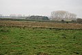
 Breed Fen, Wicken - geograph.org.uk - 5816827.jpg 1,024 × 768; 303 KB
-
 Bridleway past Old Fordey Farm - geograph.org.uk - 2693608.jpg 1,600 × 1,200; 659 KB
-
 Brimstone nectaring on thistle, Wicken Fen - geograph.org.uk - 3996549.jpg 1,024 × 682; 587 KB
-
 Bush and maize - geograph.org.uk - 4310993.jpg 640 × 430; 92 KB
-
 Butterfly Trail and Bench, Wicken Fen - geograph.org.uk - 2696931.jpg 640 × 480; 109 KB
-
 Butts Farmhouse (geograph 6856046).jpg 1,024 × 684; 175 KB
-
 By Fodderfen Drove - geograph.org.uk - 4317240.jpg 640 × 430; 54 KB
-
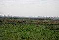
 Cam Washes - geograph.org.uk - 4623182.jpg 2,560 × 1,920; 1.83 MB
-
 Cam Washes, Upware - geograph.org.uk - 4045849.jpg 1,600 × 1,200; 753 KB
-
 Cambridgeshire Farmland - geograph.org.uk - 4317270.jpg 640 × 430; 44 KB
-
 Cambridgeshire Farmland - geograph.org.uk - 4317294.jpg 640 × 430; 77 KB
-
 Cambridgeshire Farmland - geograph.org.uk - 4317350.jpg 640 × 430; 72 KB
-
 Cattle grazing, Kingfishers Bridge - geograph.org.uk - 4310632.jpg 640 × 430; 57 KB
-
 Cemetery in Wicken, Cambridgeshire - geograph.org.uk - 4456973.jpg 4,320 × 3,240; 5.68 MB
-
 Chestnut Cottage, Village Green, Wicken - geograph.org.uk - 6157555.jpg 1,024 × 768; 234 KB
-
 Chestnut Tree Farm - geograph.org.uk - 1482406.jpg 640 × 480; 89 KB
-
 Cleared scrub across Wicken Lode - geograph.org.uk - 4458366.jpg 6,000 × 4,000; 5.22 MB
-
 Cow on the river bank - geograph.org.uk - 4277405.jpg 1,600 × 1,200; 610 KB
-
 Cranes (Grus grus) at Wicken Fen - geograph.org.uk - 3453377.jpg 974 × 1,024; 146 KB
-
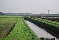 Cross Bank Drain - geograph.org.uk - 4305329.jpg 640 × 430; 65 KB
-
 Dark fenland soil - geograph.org.uk - 4322530.jpg 640 × 430; 67 KB
-
 Dark soil - geograph.org.uk - 4322499.jpg 640 × 430; 60 KB
-
 Dense vegetation by Fen Rivers Walk - geograph.org.uk - 4317337.jpg 640 × 430; 144 KB
-
 Diminishing dead tree - geograph.org.uk - 4629846.jpg 2,560 × 1,920; 1.71 MB
-
 Dimmock's Cote - geograph.org.uk - 4629649.jpg 2,560 × 1,920; 1.6 MB
-
 Dimmock's Cote Bridge - geograph.org.uk - 4056600.jpg 4,320 × 3,240; 3.91 MB
-
 Dimmock's Cote Quarry - geograph.org.uk - 4311006.jpg 640 × 430; 48 KB
-
 Dimmock's Cote Quarry - geograph.org.uk - 4311009.jpg 640 × 430; 48 KB
-
 Dimmock's Cote Quarry - geograph.org.uk - 4311012.jpg 640 × 430; 53 KB
-
 Dimmock's Cote Quarry, Wicken - geograph.org.uk - 4056562.jpg 3,893 × 2,430; 2.61 MB
-
 Ditch across Fidwell Fen - geograph.org.uk - 4629611.jpg 2,560 × 1,920; 1.77 MB
-
 Ditch by Fen Rivers Way - geograph.org.uk - 4322547.jpg 640 × 430; 92 KB
-
 Ditch junction - geograph.org.uk - 4322549.jpg 640 × 430; 104 KB
-
 Ditch, Fidwell Fen - geograph.org.uk - 4624595.jpg 2,560 × 1,920; 2.04 MB
-
 Docking's Lane - geograph.org.uk - 2573827.jpg 1,600 × 1,200; 951 KB
-
 Docking's Lane flooded - geograph.org.uk - 4352575.jpg 5,472 × 3,648; 2.22 MB
-
-
 Drainage channel on Wicken Fen - geograph.org.uk - 5001664.jpg 1,920 × 1,080; 641 KB
-

-
 Drainage Windpump, Wicken Fen Nature Reserve - geograph.org.uk - 6157623.jpg 1,024 × 768; 224 KB
-
 Drainage Windpump, Wicken Fen Nature Reserve - geograph.org.uk - 6157643.jpg 768 × 1,024; 180 KB
-
 Drainer's Dyke - geograph.org.uk - 2573860.jpg 1,600 × 1,200; 877 KB
-
 Drainer's Dyke, Wicken Fen - geograph.org.uk - 2474101.jpg 545 × 640; 75 KB
-
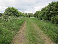
 Drove Lane - geograph.org.uk - 2520085.jpg 640 × 480; 111 KB
-
 Drove Lane, Wicken - geograph.org.uk - 5009588.jpg 480 × 640; 112 KB
-
 Drove Lane, Wicken - geograph.org.uk - 5009589.jpg 480 × 640; 71 KB
-
 Drove Lane, Wicken - geograph.org.uk - 5009596.jpg 480 × 640; 83 KB
-
 Drove Lane, Wicken - geograph.org.uk - 5009598.jpg 640 × 480; 57 KB
-
 Embankment by Fen Rivers Way - geograph.org.uk - 4310627.jpg 640 × 430; 56 KB
-
 Empty house at Padney Farm - geograph.org.uk - 4352516.jpg 5,252 × 3,509; 1.35 MB
-
 Entrance to Upware Marina - geograph.org.uk - 3641410.jpg 640 × 444; 285 KB
-
 Ephemera vulgata . Mayfly - Flickr - gailhampshire.jpg 2,168 × 2,091; 570 KB
-
 Evening sky over the Sedge Fen, Wicken - geograph.org.uk - 3458379.jpg 1,024 × 768; 142 KB
-
 Fallen sign next to Wicken lime quarry - geograph.org.uk - 4227006.jpg 4,204 × 3,080; 5.47 MB
-
 Fan Tail and Cap at Wicken Mill - geograph.org.uk - 3465280.jpg 1,942 × 1,456; 577 KB
-
 Farm track bridge over New River - geograph.org.uk - 1482544.jpg 640 × 480; 86 KB
-
 Farm track near Upware - geograph.org.uk - 5065147.jpg 640 × 480; 94 KB
-
 Farm track to Upware Rd - geograph.org.uk - 4317242.jpg 640 × 430; 50 KB
-
 Farmland - geograph.org.uk - 4310936.jpg 640 × 430; 100 KB
-
 Farmland - geograph.org.uk - 4310995.jpg 640 × 430; 50 KB
-
 Farmland - woodland boundary - geograph.org.uk - 4305366.jpg 640 × 430; 53 KB
-
 Farmland by Dimmock's Cote Quarry - geograph.org.uk - 4311011.jpg 640 × 430; 44 KB
-
 Farmland by Fodderfen Drove - geograph.org.uk - 4317218.jpg 640 × 430; 55 KB
-
 Farmland by Fodderfen Drove - geograph.org.uk - 4317221.jpg 640 × 430; 62 KB
-
 Farmland by Fodderfen Drove - geograph.org.uk - 4317236.jpg 640 × 430; 60 KB
-
 Farmland by Fodderfen Drove - geograph.org.uk - 4317272.jpg 640 × 430; 52 KB
-
 Farmland by Fodderfen Drove - geograph.org.uk - 4317276.jpg 640 × 430; 53 KB
-
 Farmland by Fodderfen Drove - geograph.org.uk - 4317286.jpg 640 × 430; 55 KB
-
 Farmland by Fodderfen Drove - geograph.org.uk - 4317291.jpg 640 × 430; 52 KB
-
 Farmland by the A1123 - geograph.org.uk - 3940206.jpg 2,592 × 1,944; 1.73 MB
-
 Farmland east of Upware Road - geograph.org.uk - 5065205.jpg 640 × 480; 136 KB
-
 Farmland near Gray's Farm - geograph.org.uk - 3940262.jpg 2,592 × 1,944; 1.97 MB
-
 Farmland near Padney Farm south of Barway - geograph.org.uk - 4674070.jpg 4,320 × 3,240; 5.37 MB
-
 Farmland near Upware - geograph.org.uk - 3940201.jpg 2,592 × 1,944; 1.78 MB
-
 Farmland north of Upware - geograph.org.uk - 4317351.jpg 640 × 430; 57 KB
-
 Farmland, woodland boundary - geograph.org.uk - 4310942.jpg 640 × 430; 58 KB
-
 Fen Cottage, Wicken - geograph.org.uk - 3490049.jpg 1,280 × 856; 390 KB
-
 Fen Landscape - geograph.org.uk - 2445197.jpg 800 × 531; 82 KB
-
 Fen Rivers Way - geograph.org.uk - 2693274.jpg 1,600 × 1,200; 977 KB
-
 Fen Rivers Way - geograph.org.uk - 4305331.jpg 640 × 430; 51 KB
-
 Fen Rivers Way - geograph.org.uk - 4305335.jpg 640 × 430; 72 KB
-
 Fen Rivers Way - geograph.org.uk - 4305343.jpg 640 × 430; 58 KB
-
 Fen Rivers Way - geograph.org.uk - 4305350.jpg 640 × 430; 53 KB
-
 Fen Rivers Way - geograph.org.uk - 4305361.jpg 640 × 430; 61 KB
-
 Fen Rivers Way - geograph.org.uk - 4305367.jpg 640 × 430; 125 KB
-
 Fen Rivers Way - geograph.org.uk - 4305368.jpg 640 × 430; 107 KB
-
 Fen Rivers Way - geograph.org.uk - 4305374.jpg 640 × 430; 104 KB
-
 Fen Rivers Way - geograph.org.uk - 4310617.jpg 640 × 430; 76 KB
-
 Fen Rivers Way - geograph.org.uk - 4310623.jpg 640 × 430; 77 KB
-
 Fen Rivers Way - geograph.org.uk - 4310630.jpg 640 × 430; 66 KB
-
 Fen Rivers Way - geograph.org.uk - 4310635.jpg 640 × 430; 63 KB
-
 Fen Rivers Way - geograph.org.uk - 4310661.jpg 640 × 430; 105 KB
-
 Fen Rivers Way - geograph.org.uk - 4310912.jpg 640 × 430; 62 KB
-
 Fen Rivers Way - geograph.org.uk - 4310924.jpg 640 × 430; 99 KB
-
 Fen Rivers Way - geograph.org.uk - 4310939.jpg 640 × 430; 108 KB
-
 Fen Rivers Way - geograph.org.uk - 4310994.jpg 640 × 430; 89 KB
-
 Fen Rivers Way - geograph.org.uk - 4311000.jpg 640 × 430; 62 KB
-
 Fen Rivers Way - geograph.org.uk - 4317332.jpg 640 × 430; 88 KB
-
 Fen Rivers Way - geograph.org.uk - 4317334.jpg 640 × 430; 101 KB
-
 Fen Rivers Way - geograph.org.uk - 4317342.jpg 640 × 430; 128 KB
-
 Fen Rivers Way - geograph.org.uk - 4317345.jpg 640 × 430; 123 KB
-
 Fen Rivers Way - geograph.org.uk - 4322525.jpg 640 × 430; 87 KB
-
 Fen Rivers Way - geograph.org.uk - 4322537.jpg 640 × 430; 92 KB
-
 Fen Rivers Way - geograph.org.uk - 4322544.jpg 640 × 430; 89 KB
-
 Fen Rivers Way - geograph.org.uk - 4322564.jpg 640 × 430; 66 KB
-
 Fen Rivers Way - geograph.org.uk - 4322570.jpg 640 × 430; 74 KB
-
 Fen Rivers Way - geograph.org.uk - 4322603.jpg 640 × 430; 98 KB
-
 Fen Rivers Way - geograph.org.uk - 4623178.jpg 2,560 × 1,920; 2.33 MB
-
 Fen Rivers Way - geograph.org.uk - 4624621.jpg 2,560 × 1,920; 2.17 MB
-
 Fen Rivers Way - geograph.org.uk - 4624663.jpg 2,560 × 1,920; 2.08 MB
-
 Fen Rivers Way logo - geograph.org.uk - 4317321.jpg 640 × 430; 55 KB
-
 Fenland by the River Cam - geograph.org.uk - 4305359.jpg 640 × 430; 59 KB
-
 Fenland farmland - geograph.org.uk - 4305322.jpg 640 × 430; 56 KB
-
 Fenland field - geograph.org.uk - 4305342.jpg 640 × 430; 47 KB
-
 Fenland footpath over Soham Mere - geograph.org.uk - 4674060.jpg 4,320 × 3,240; 5.54 MB
-
 Fenland scene - geograph.org.uk - 4301241.jpg 640 × 430; 65 KB
-
 Fenland towards Soham - geograph.org.uk - 4352754.jpg 5,472 × 3,648; 1.88 MB
-
 Fenside Farm - geograph.org.uk - 5065247.jpg 640 × 480; 100 KB
-
 Fidwell Fen - geograph.org.uk - 1979646.jpg 640 × 429; 45 KB
-
 Fidwell Fen - geograph.org.uk - 4623196.jpg 2,560 × 1,920; 1.66 MB
-
 Fidwell Fen - geograph.org.uk - 4629602.jpg 2,560 × 1,920; 1.82 MB
-
 Field and windmill near Wicken - geograph.org.uk - 4456939.jpg 6,000 × 4,000; 3.45 MB
-
 Field boundary at Padney - geograph.org.uk - 4352525.jpg 5,472 × 3,648; 2.21 MB
-
 Field drain - geograph.org.uk - 4310927.jpg 640 × 430; 99 KB
-
 Field in fenland - geograph.org.uk - 3461678.jpg 1,600 × 1,200; 281 KB
-
 Field of barley - geograph.org.uk - 5065233.jpg 640 × 480; 107 KB
-
 Field of Brassicas - geograph.org.uk - 4317219.jpg 640 × 430; 71 KB
-
 Field of Maize - geograph.org.uk - 4310989.jpg 640 × 430; 47 KB
-
 Field of stubble - geograph.org.uk - 4305362.jpg 640 × 430; 57 KB
-
 Fields by the Cam - geograph.org.uk - 4277392.jpg 1,600 × 1,200; 759 KB
-
 Fields near Upware - geograph.org.uk - 4244503.jpg 1,600 × 1,200; 664 KB
-
 Fields of grain - geograph.org.uk - 5065314.jpg 640 × 480; 122 KB
-
 Fish ^ Duck Marina - geograph.org.uk - 4277395.jpg 1,600 × 1,200; 667 KB
-
 FIVE MILES FROM ANYWHERE NO HURRY INN - geograph.org.uk - 4227009.jpg 4,320 × 3,240; 5.7 MB
-

-

-
 Flat farmland - geograph.org.uk - 4301234.jpg 640 × 430; 69 KB
-
 Flat farmland - geograph.org.uk - 4310998.jpg 640 × 430; 43 KB
-
 Flat farmland near Wicken - geograph.org.uk - 4456923.jpg 6,000 × 4,000; 3.57 MB
-
 Flat fenland farmland - geograph.org.uk - 4305338.jpg 640 × 430; 74 KB
-
 Flat fenland farmland - geograph.org.uk - 4305349.jpg 640 × 430; 42 KB
-
 Flat land, big sky, Wicken Fen - geograph.org.uk - 2994371.jpg 640 × 427; 129 KB
-
 Fodder Fen - geograph.org.uk - 4317300.jpg 640 × 430; 48 KB
-
 Fodder Fen - geograph.org.uk - 4317306.jpg 640 × 430; 65 KB
-
 Fodder Fen - geograph.org.uk - 4317312.jpg 640 × 430; 59 KB
-
 Fodder Fen - geograph.org.uk - 4317328.jpg 640 × 387; 45 KB
-
 Fodderfen Drove - geograph.org.uk - 2573851.jpg 1,600 × 1,200; 939 KB
-
 Fodderfen Drove - geograph.org.uk - 4311021.jpg 640 × 430; 68 KB
-
 Fodderfen Drove - geograph.org.uk - 4317201.jpg 640 × 430; 75 KB
-
 Fodderfen Drove - geograph.org.uk - 4317237.jpg 640 × 430; 98 KB
-
 Fodderfen Drove - geograph.org.uk - 4317266.jpg 640 × 430; 88 KB
-
 Fodderfen Drove - geograph.org.uk - 4317281.jpg 640 × 430; 87 KB
-
 Fodderfen Drove - geograph.org.uk - 4317288.jpg 640 × 430; 75 KB
-
 Fodderfen Drove - geograph.org.uk - 4317292.jpg 640 × 430; 88 KB
-
 Footbridge on path to visitor facilities - geograph.org.uk - 3643837.jpg 640 × 480; 365 KB
-
 Footbridge over New River - geograph.org.uk - 4353008.jpg 5,472 × 3,648; 3.03 MB
-
 Footpath into Fodder Fen - geograph.org.uk - 2520025.jpg 640 × 480; 95 KB
-
 Footpath junction - geograph.org.uk - 4310668.jpg 640 × 430; 124 KB
-
 Footpath to New River - geograph.org.uk - 2520091.jpg 640 × 480; 93 KB
-
 Footpath to Soham Lode - geograph.org.uk - 2693549.jpg 1,600 × 1,200; 793 KB
-
 Footpath to Upware Road - geograph.org.uk - 2573843.jpg 1,600 × 1,200; 731 KB


.jpg)
.jpg)


_-_geograph.org.uk_-_4972997.jpg)
_-_geograph.org.uk_-_4973042.jpg)


,_Wicken_Fen_-_geograph.org.uk_-_5816824.jpg)
,_Wicken_Fen_-_geograph.org.uk_-_5816834.jpg)


.jpg)


_at_Wicken_Fen_-_geograph.org.uk_-_3453377.jpg)


